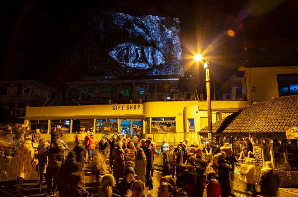
Cheddar Gorge digital projection event – many thanks to the 1000+ people who came!
All of the images are now on the Mendip Hills National Landscape website.
I’ve just published a new guest blog about this project for Seed Sedgemoor. Check it out here.
When I started this commission, I planned to create a series of highly saturated, colour images for the projection event. Upon reflection however, I’ve decided that monochrome imagery would be more effective because (i) it ensures that the source photograph, sculpture and landscape are all part of the same visual language and (ii) the black and white images will be easier to ‘read’ on the highly textured rock surfaces of Cheddar Gorge.
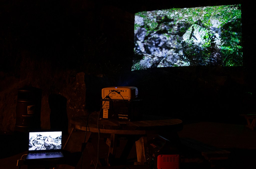
The repeated projection tests have also identified the need to create two separate sets of image files; one for the projection event itself (with very high levels of contrast and brightness) and another for web/print.
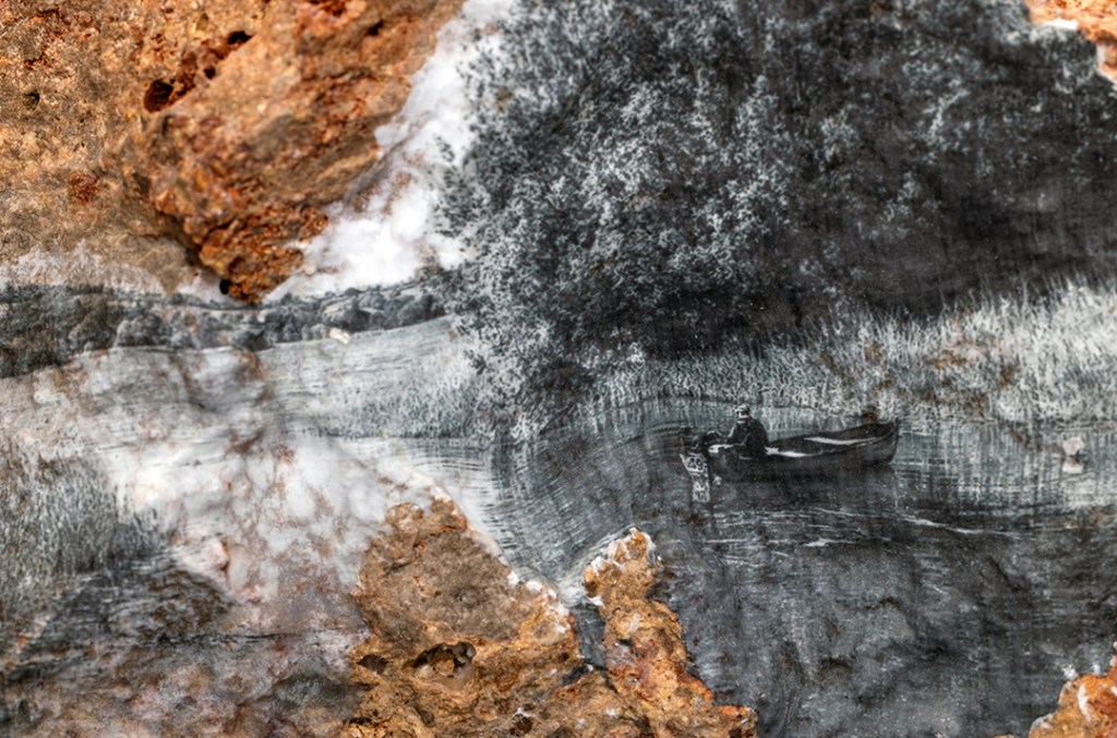
My latest visit to the Mendip Hills involved photographing the reservoirs, which link into two of the area’s Special Qualities: ‘the limestone aquifer feeding the reservoirs’ and ‘the Chew Valley’.
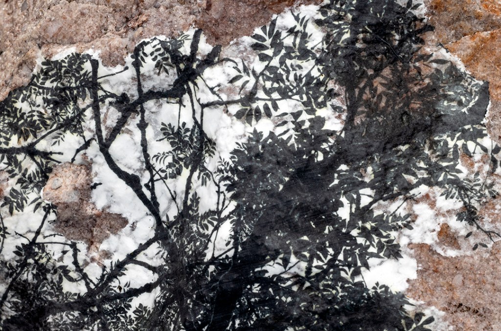
As part of the project, I’ve printed a photograph of a fishing boat floating on one of the artificial lakes onto a local specimen of Dolomitic Conglomerate. This rock type was deposited by running water during the Triassic Period (around 250-200 million years ago) when the mountains of the Mendip Hills were being rapidly eroded. Today, Triassic rocks underlie each of the three large reservoirs in the region.
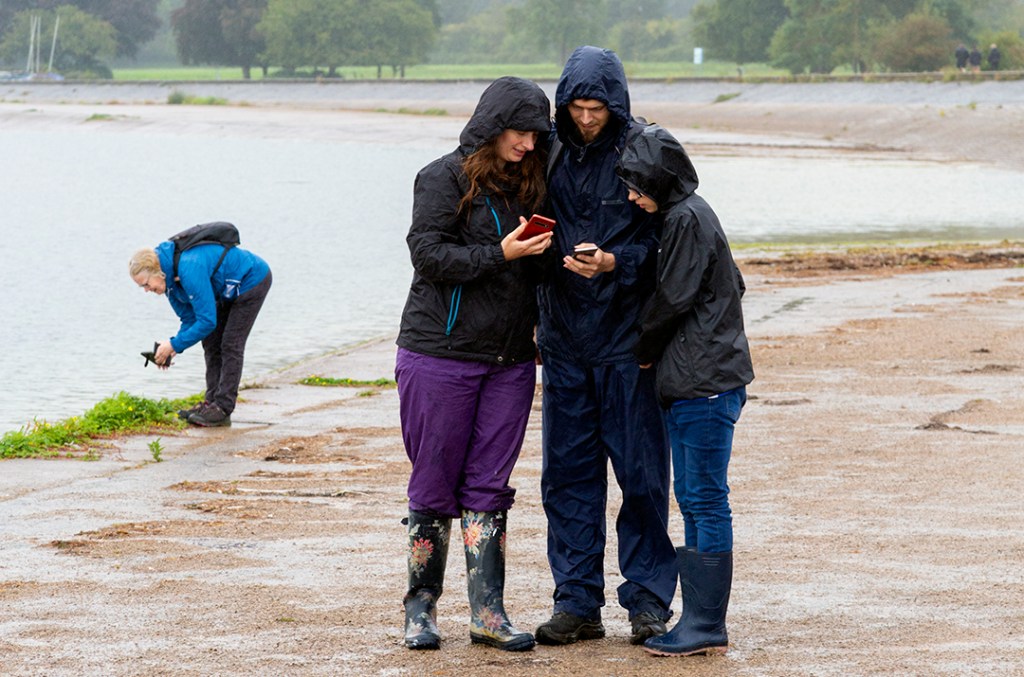
It may have been rather grey and wet yesterday, but we still had a lot of fun at Cheddar Reservoir with our two public workshops. I led several photo walks during the day and developed lots of cyanotype prints. We also had some amazing digital activities – green screen and light painting – run by Somerset Film, archive film footage (courtesy of Windrose Rural Media Trust) and a geology trail (developed by Somerset Earth Science Centre).
Here’s another behind the scenes peak at some of my recent project development work. On my last trip, I was photographing ancient woodland combes, which are one of the ‘Special Qualities’ of the landscape. Back in the studio, I transferred a photograph of an ash canopy onto a local specimen of Quartzitic Sandstone. This rock type was deposited in a river delta during the Upper Carboniferous (around 300 million years ago) when the Mendip Hills was essentially a swampy, tropical rainforest!
Accessing suitable archive imagery for the photographic transfers has been incredibly difficult. There are issues with copyright, permissions and image resolution that I won’t be able to resolve within the project timeframe. My revised plan is therefore to take my own photographs of cultural/historic features and human activities and print those onto the rock specimens. This should give me much greater flexibility in creating my sculptures and hopefully, generate far more successful results.
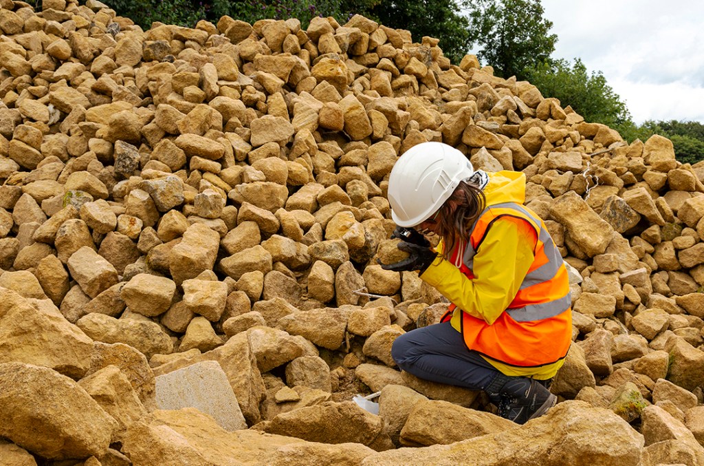
Collecting suitable rock specimens for this project has proved somewhat problematic because many of the best geological outcrops in the Mendip Hills are situated within SSSIs. I’ve therefore enlisted the help of the Somerset Earth Science Centre. They’ve helped me to access to several key sites and provided me with extensive material from their geological collection. Their support has been invaluable!
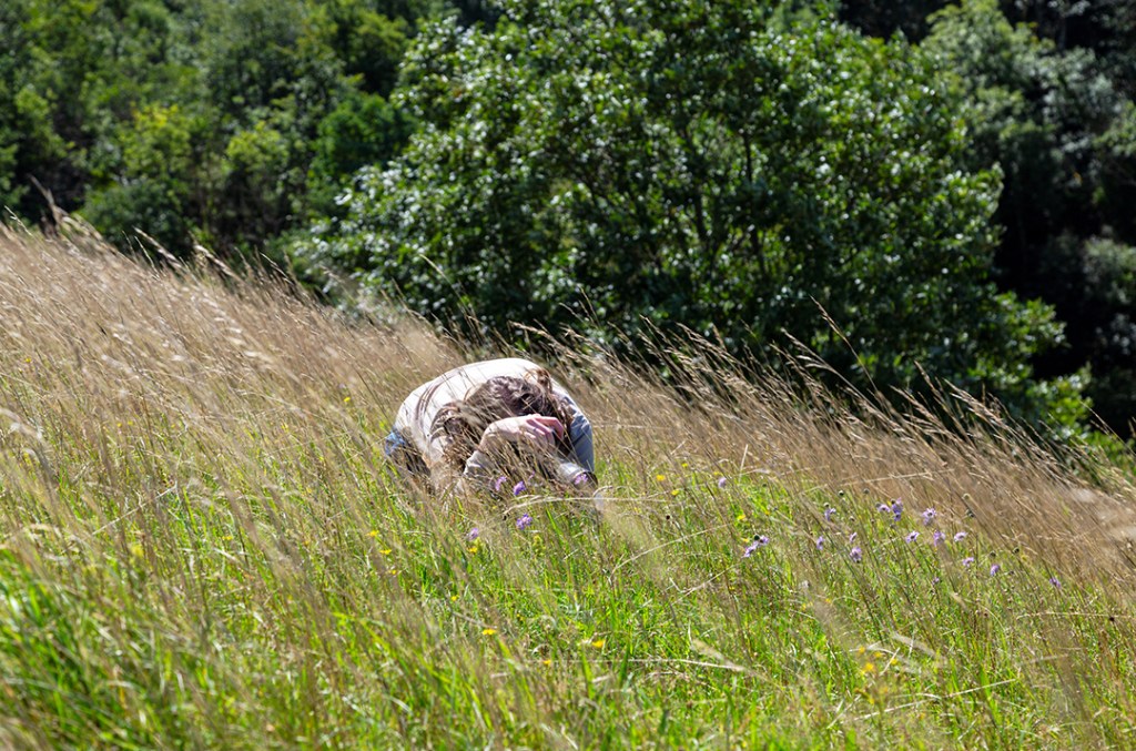
I’ve been researching the 12 special qualities that make the Mendip Hills an area of outstanding natural beauty. Yesterday, I spent a lot of time exploring the rare and important limestone grasslands with my family. These wildflower rich habitats can be found on many of the south facing slopes in the region, where the thin, well drained soils warm up quickly in the summer months.
If you look closely, there are so many different plants and animals to be found. We saw butterflies and moths, grasshoppers and crickets, and even a snake (but sadly it was far too quick for my camera)!
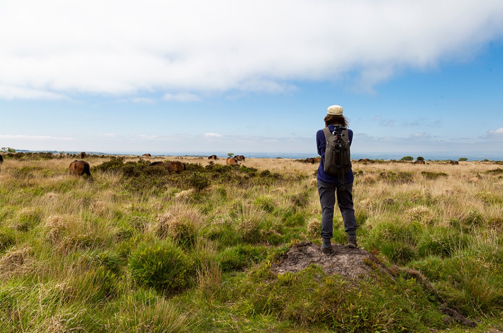
A beautiful morning spent walking on the Black Down heathlands! There’s just so much to see: Bronze Age burial mounds, rows of WWII tumps, the ‘Starfish’ bunker, and of course Exmoor ponies. I live on the outskirts of Exmoor National Park, so hiking on Black Down seemed strangely familiar to me (what with the heather, gorse and wild ponies). The ponies graze the land, keeping the vegetation low, and allowing the heather and grasses to flourish.
As part of the ongoing project I’ve been thinking a lot about how landscapes are altered by a mixture of geology and human activity. The Black Down heathlands are a great example of this; (i) the combination of Old Red Sandstone and high rainfall creating acidic, waterlogged soils, (ii) the removal of trees by our ancient ancestors keeping the soil damp, and now (iii) the reintroduction of grazing animals to improve the ecological diversity. I’m looking forward to discovering more of these environmental connections over the summer.

I had a wonderful day at Cheddar Gorge and Caves yesterday teaching the first of my ‘Moments on Mendip’ workshops. We had just enough time to squeeze in a photo walk, cyanotypes and lumen printing.
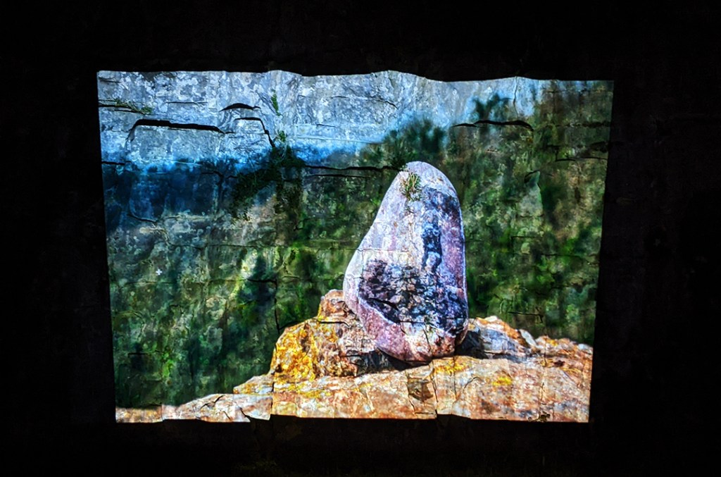
Our first test projection in Cheddar Gorge was absolutely fascinating. The rough surfaces of the natural rock faces seem to add a 3D effect to my images; they become textured and fragmented, which looks great. It’s obvious from the testing however, that I’ll need to significantly increase the brightness and contrast of my photographs to ensure that the details can be seen during the projection event. We’ve also been able to identify between about six and eight key locations for the projected images.
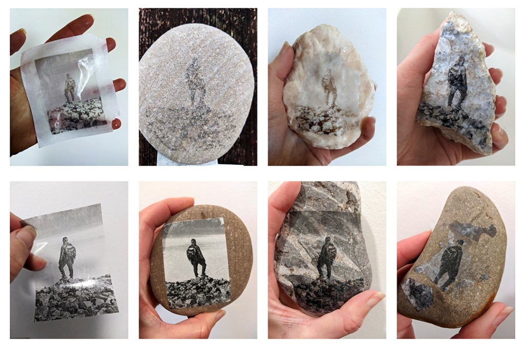
Here are some of the image transfer techniques I’ve been experimenting with recently. So far, I tested the effects of using different transfer media, paper stock, printing techniques, image processing techniques and rock substrates.
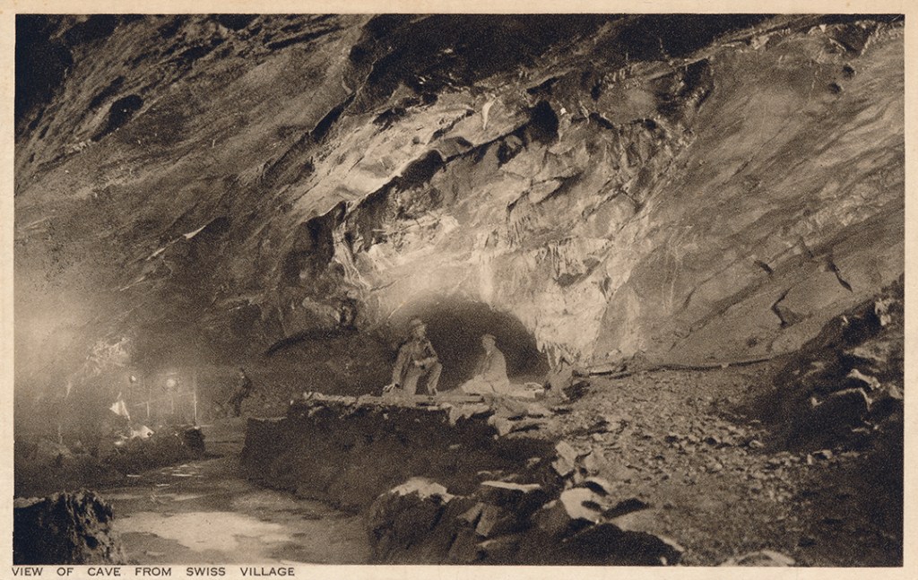
I recently found this postcard in a local second-hand shop. I don’t know how old the photograph is but it shows two men exploring the caves at Cheddar. I’m planning to combine archive imagery with local rock specimens for this project, perhaps via image transfer, paper sculpture, collage and/or projection. I’m particularly interested in finding photographs of people influencing the landscape in same way, e.g., farming, building, mining, quarrying, caving etc.
I grew up near the Mendip Hills and one of my favourite places to visit as a child was Cheddar Gorge and Caves. I’m certain those early day trips inspired my former career as a geologist. So going back to the same places now – as a photographic artist – feels really special. Given my background, I’ve been thinking a lot about how this spectacular landscape was formed and about what makes it unique. I keep coming back to the idea that a landscape is shaped by a combination of both natural processes and human activities. So this is what I’ll be investigating over the next few months as I continue exploring the landscape and creating my images.
The project was commissioned by the Mendip Hills AONB Service (now the Mendip Hills National Landscape) through Seed Sedgemoor and the Arts Council England’s Creative People and Places programme. It was delivered in partnership with Somerset Film, Somerset Earth Science Centre, The Mendip Society, and Windrose Rural Media Trust.


You must be logged in to post a comment.